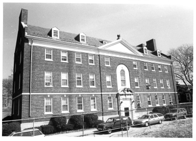
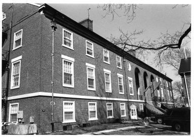
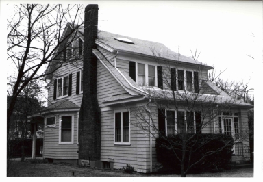
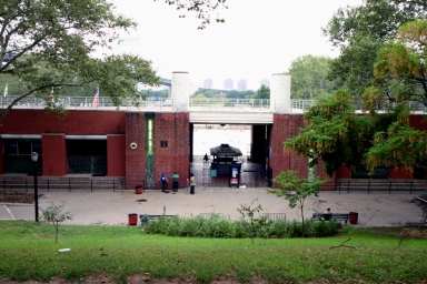
Landmark Name
Who What Where WhenREMOVE |
Landmark Name
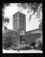
The Cloisters
Address
Fort Tryon Park
Image Type
Designation Photos
File Name
LP0835_001.jpg
Landmark Name
The Cloisters
Address
Fort Tryon Park
Image Type
Designation Photos
File Name
LP0835_002.jpg
Landmark Name
The Cloisters
Address
Fort Tryon Park
Image Type
Designation Photos
File Name
LP0835_003.jpg
Landmark Name
The Cloisters
Address
Fort Tryon Park
Image Type
Designation Photos
File Name
LP0835_004.jpg
Landmark Name
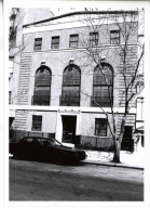
Carnegie Hill Historic District
Address
5-7 East 92nd Street
Image Type
Designation Photos
File Name
LP0861_032_5-7E92ndSt.jpg
Landmark Name
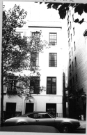
Carnegie Hill Historic District
Address
65 East 92nd Street
Image Type
Designation Photos
File Name
LP0861_056_65E92ndSt.jpg
Landmark Name
Carnegie Hill Historic District
Address
65 East 92nd Street
Image Type
Designation Photos
File Name
LP0861_146_65E92ndSt.jpg
Landmark Name
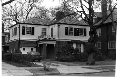
Prospect Park South Historic District
Address
209 Rugby Road
Image Type
Designation Photos
File Name
LP0979_194_209RugbyRd.jpg
Landmark Name
Upper East Side Historic District
Address
32 East 74th Street
Image Type
Designation Photos
File Name
LP1051_590_32E74thSt.jpg
Landmark Name
Upper West Side/Central Park West Historic District
Address
175 Central Park West (aka 1-99 West 77th Street; 2-98 West 81st Street)
Image Type
Designation Photos
File Name
LP1647_379_175CPW.jpg
Landmark Name
Upper West Side/Central Park West Historic District
Address
175 Central Park West (aka 1-99 West 77th Street; 2-98 West 81st Street)
Image Type
Designation Photos
File Name
LP1647_385_175CPW.jpg
Landmark Name
F.W.I.L. Lundy Brothers Restaurant Building
Address
1901-1929 Emmons Avenue
Image Type
Designation Photos
File Name
LP1706_001.tif
Landmark Name
F.W.I.L. Lundy Brothers Restaurant Building
Address
1901-1929 Emmons Avenue
Image Type
Designation Photos
File Name
LP1706_002.tif
Landmark Name
F.W.I.L. Lundy Brothers Restaurant Building
Address
1901-1929 Emmons Avenue
Image Type
Designation Photos
File Name
LP1706_003.tif
Landmark Name
F.W.I.L. Lundy Brothers Restaurant Building
Address
1901-1929 Emmons Avenue
Image Type
Designation Photos
File Name
LP1706_004.tif
Landmark Name
F.W.I.L. Lundy Brothers Restaurant Building
Address
1901-1929 Emmons Avenue
Image Type
Designation Photos
File Name
LP1706_005.tif
Landmark Name
F.W.I.L. Lundy Brothers Restaurant Building
Address
1901-1929 Emmons Avenue
Image Type
Designation Photos
File Name
LP1706_006.tif
Landmark Name
F.W.I.L. Lundy Brothers Restaurant Building
Address
1901-1929 Emmons Avenue
Image Type
Designation Photos
File Name
LP1706_007.tif
Landmark Name
F.W.I.L. Lundy Brothers Restaurant Building
Address
1901-1929 Emmons Avenue
Image Type
Designation Photos
File Name
LP1706_008.tif
Landmark Name
F.W.I.L. Lundy Brothers Restaurant Building
Address
1901-1929 Emmons Avenue
Image Type
Designation Photos
File Name
LP1706_009.tif
Landmark Name
F.W.I.L. Lundy Brothers Restaurant Building
Address
1901-1929 Emmons Avenue
Image Type
Designation Photos
File Name
LP1706_010.tif
Landmark Name
F.W.I.L. Lundy Brothers Restaurant Building
Address
1901-1929 Emmons Avenue
Image Type
Designation Photos
File Name
LP1706_011.tif
Landmark Name
F.W.I.L. Lundy Brothers Restaurant Building
Address
1901-1929 Emmons Avenue
Image Type
Designation Photos
File Name
LP1706_012.tif
Landmark Name
F.W.I.L. Lundy Brothers Restaurant Building
Address
1901-1929 Emmons Avenue
Image Type
Designation Photos
File Name
LP1706_013.tif
Landmark Name
F.W.I.L. Lundy Brothers Restaurant Building
Address
1901-1929 Emmons Avenue
Image Type
Designation Photos
File Name
LP1706_015.tif
Landmark Name
F.W.I.L. Lundy Brothers Restaurant Building
Address
1901-1929 Emmons Avenue
Image Type
Designation Photos
File Name
LP1706_016.tif
Landmark Name
F.W.I.L. Lundy Brothers Restaurant Building
Address
1901-1929 Emmons Avenue
Image Type
Designation Photos
File Name
LP1706_017.tif
Landmark Name
Governors Island Historic District
Address
Building No. 111 (between Carder Road and Andes Road)
Image Type
Designation Photos
File Name
LP1946_032_Bldg111.jpg
Landmark Name
Governors Island Historic District
Address
Building No. 111 (between Carder Road and Andes Road)
Image Type
Designation Photos
File Name
LP1946_033_Bldg111.jpg
Landmark Name
Governors Island Historic District
Address
Building No. 112 (between Carder Road and Andes Road)
Image Type
Designation Photos
File Name
LP1946_034_Bldg112.jpg
Landmark Name
Governors Island Historic District
Address
Building No. 112 (between Carder Road and Andes Road)
Image Type
Designation Photos
File Name
LP1946_035_Bldg112.jpg
Landmark Name
Governors Island Historic District
Address
Building No. 114 (Across from Castle Williams, between Carder Road and Andes Road)
Image Type
Designation Photos
File Name
LP1946_036_Bldg114.jpg
Landmark Name
Governors Island Historic District
Address
Building No. 125 (hilltop site north of Andes Road in the midst of the New York Arsenal buildings)
Image Type
Designation Photos
File Name
LP1946_037_Bldg125.jpg
Landmark Name
Governors Island Historic District
Address
Building No. 125 (hilltop site north of Andes Road in the midst of the New York Arsenal buildings)
Image Type
Designation Photos
File Name
LP1946_038_Bldg125.jpg
Landmark Name
Governors Island Historic District
Address
Building No. 301 (overlooking Buttermilk Channel, south of Kimmel Road)
Image Type
Designation Photos
File Name
LP1946_053_Bldg301.jpg
Landmark Name
Douglaston Historic District
Address
239 Hillside Avenue (aka 239 38th Road; 239-01 38th Road; 239-03 38th Road)
Image Type
Designation Photos
File Name
LP1957_910_239HillsideAve.jpg
Landmark Name
Douglaston Historic District
Address
239 Hillside Avenue (aka 239 38th Road; 239-01 38th Road; 239-03 38th Road)
Image Type
Designation Photos
File Name
LP1957_911_239HillsideAve.jpg
Landmark Name
Douglaston Historic District
Address
239 Hillside Avenue (aka 239 38th Road; 239-01 38th Road; 239-03 38th Road)
Image Type
Designation Photos
File Name
LP1957_912_239HillsideAve.jpg
Landmark Name
Douglaston Historic District
Address
127 Prospect Avenue
Image Type
Designation Photos
File Name
LP1957_1661_127ProspectAve.jpg
Landmark Name
Douglaston Historic District
Address
127 Prospect Avenue
Image Type
Designation Photos
File Name
LP1957_1662_127ProspectAve.jpg
Landmark Name
Douglaston Historic District
Address
127 Prospect Avenue
Image Type
Designation Photos
File Name
LP1957_1663_127ProspectAve.jpg
Landmark Name
NoHo Historic District
Address
248 Mercer Street
Image Type
Designation Photos
File Name
LP2039_397_248MercerSt.jpg
Landmark Name
NoHo Historic District
Address
248 Mercer Street
Image Type
Designation Photos
File Name
LP2039_398_248MercerSt.jpg
Landmark Name
Astoria Park Pool and Play Center
Address
19th Street between 22nd Drive and Hoyt Avenue North
Image Type
Designation Photos
File Name
LP2196_2005-08-16_001.jpg
Landmark Name
Astoria Park Pool and Play Center
Address
19th Street between 22nd Drive and Hoyt Avenue North
Image Type
Designation Photos
File Name
LP2196_2005-08-16_002.jpg
Landmark Name
Astoria Park Pool and Play Center
Address
19th Street between 22nd Drive and Hoyt Avenue North
Image Type
Designation Photos
File Name
LP2196_2005-08-16_003.jpg
Landmark Name
Astoria Park Pool and Play Center
Address
19th Street between 22nd Drive and Hoyt Avenue North
Image Type
Designation Photos
File Name
LP2196_2005-08-16_004.jpg
Landmark Name
Astoria Park Pool and Play Center
Address
19th Street between 22nd Drive and Hoyt Avenue North
Image Type
Designation Photos
File Name
LP2196_2005-08-16_005.jpg
Landmark Name
Astoria Park Pool and Play Center
Address
19th Street between 22nd Drive and Hoyt Avenue North
Image Type
Designation Photos
File Name
LP2196_2005-08-16_006.jpg
|


